
Maps have always been powerful tools. Not only do they help us find our way, but they also shape how we understand and interact with the world.
Throughout history, some maps have done more than just guide travelers—they’ve shifted perspectives, challenged beliefs, and even changed how civilizations view themselves.
This post explores six groundbreaking maps that redefined our worldview. From ancient cartography to modern visualizations, these maps prove that a simple outline on paper can hold immense cultural, scientific, and political significance.
What Makes Maps so Powerful?
Maps are more than geographic tools. They are reflections of how humans perceive and understand their surroundings.
A map can tell us what a culture valued, where they thought they stood in the world, or even what they feared. This is why certain maps have become milestones in history.
Now, let’s explore six of them.
1. The Babylonian World Map (600 BCE)
How it Changed Our Worldview: The earliest known map to depict the world as the Babylonians saw it.
The Babylonian World Map, also known as Imago Mundi, is etched into clay and dates back to 600 BCE. It depicts the known world as a circular disk surrounded by water, with Babylon at its center. This map wasn’t designed for navigation—it was a symbolic representation of the Babylonians’ place in the cosmos.
The map reveals much about their worldview, showing their belief that the world revolved around their city. It set the stage for future cartographers to combine geographic knowledge with cultural context.
Key Takeaway: Maps are not just about geography—they reflect the perspectives and biases of their creators.
2. Ptolemy’s World Map (2nd Century CE)
How it Changed Our Worldview: The foundation of geography as a science.
Greek scholar Claudius Ptolemy’s map revolutionized how we perceive the Earth. His concept of using latitude and longitude to pinpoint locations formed the backbone of cartography for centuries. Despite inaccuracies—like placing Earth at the center of the universe—Ptolemy’s work emphasized empirical data and evidence in map-making.
During the Renaissance, his maps were rediscovered, guiding explorers like Christopher Columbus and shaping Europe’s expansion.
Key Takeaway: Ptolemy’s work shows that precision and scientific methods can shape not just maps, but history.
3. The Hereford Mappa Mundi (1300)
How it Changed Our Worldview: Blending faith and geography in medieval cartography.
The Hereford Mappa Mundi stands as the largest medieval map still in existence and offers insight into how Europeans understood the world during the Middle Ages. It places Jerusalem at the center, emphasizing religious beliefs over geographical accuracy.
Surrounding the map are illustrations of biblical events, mythical creatures, and various cultural landmarks. This map offers a snapshot of medieval thought—a world dominated by faith and legend.
Key Takeaway: Maps can reflect the spiritual and cultural priorities of a time.
4. Mercator’s Projection (1569)
How it Changed Our Worldview: Navigation made easier with distortion as a trade-off.
Gerardus Mercator’s map projection changed cartography forever. Designed for sailors, it translated the curved surface of the Earth onto a flat, rectangular map. This allowed sailors to plot straight lines for navigation, revolutionizing maritime travel.
However, there was a cost—countries closer to the poles appeared larger than they really are. Greenland, for instance, appears the same size as Africa, despite being much smaller. This projection still sparks debates about how maps influence our perceptions of power and importance.
Key Takeaway: Maps can simplify reality, but they also shape perceptions of the world.
5. John Snow’s Cholera Map (1854)
How it Changed Our Worldview: A map used to solve a medical mystery.
John Snow’s map marked a turning point in modern epidemiology. During a cholera outbreak in London, he plotted cholera deaths onto a map and pinpointed the source of the outbreak as a contaminated water pump on Broad Street. His work demonstrated the power of visualizing data to solve real-world problems.
This map wasn’t just about geography—it was one of the earliest examples of using data visualization to identify patterns and make critical discoveries.
Key Takeaway: Maps aren’t limited to geography; they can drive innovation in fields like medicine and public health.
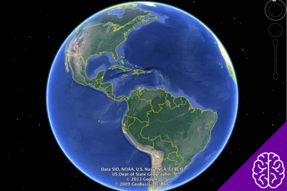
6. Google Maps (2005-Present)
How it Changed Our Worldview: Making the world accessible in our pockets.
The release of Google Maps transformed how we experience and interact with the world. Gone are the days of printed atlases—today, we have instant, real-time maps that include traffic updates, walking directions, and even satellite imagery.
Google Maps’ influence goes beyond convenience. It democratized mapping, giving individuals easy access to powerful geographic tools. Initially focused on navigation, Google Maps now integrates reviews, photos, and even AR for immersive city exploration. It has also helped businesses largely by driving new audiences to physical locations.
Key Takeaway: Digital cartography connects people to places in ways unimaginable before.
How These Maps Shape Us Today!
What these six maps have in common is their ability to transform how we see the world. From ancient Babylon’s clay tablets to Google Maps’ real-time navigation, each of these snapshots in time not only informed its audience but also changed their perspective, their habits, or their beliefs.
These maps remind us that cartography is more than a science—it’s an art and a philosophy, influencing how we perceive ourselves and others on our shared planet.
If you’re interested in exploring more about how maps evolved or how they reflect societal changes, stay tuned for future posts or explore [your additional resources or offerings, if applicable]!