

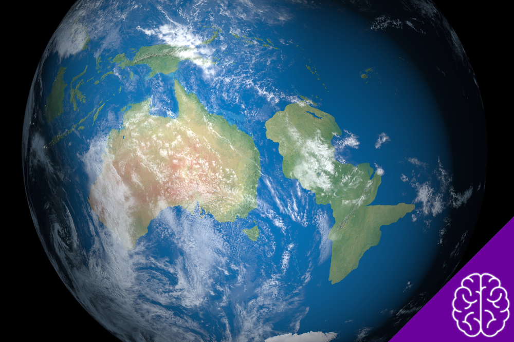
Imagine a continent almost entirely hidden beneath the ocean, with only a few islands rising above the surface. This is the story of Zealandia, a vast geological region in the southwest Pacific that remained largely overlooked on conventional world maps for generations. Often called the Forgotten Continent, it challenges the familiar idea that continents must be enormous stretches of dry land.
Scientists have spent decades investigating its rocks, crust, and underwater boundaries. Their findings reveal how Zealandia separated from an ancient supercontinent, gradually sank beneath the sea, and eventually gained recognition as a distinct continent.
Where Is the Forgotten Continent?
Zealandia lies in the southwestern Pacific Ocean, surrounding New Zealand and extending toward New Caledonia.
It covers approximately 5 million square kilometers, but most of this continental structure sits underwater.
Approximately 94% to 95% of Zealandia is submerged. Its most recognizable exposed areas include:
- New Zealand: The largest and most familiar landmass associated with Zealandia.
- New Caledonia: An island group located northwest of New Zealand.
- Smaller islands: Additional exposed fragments of the continental structure.
Beneath the ocean, plateaus, ridges, and basins connect areas that might otherwise look like separate islands and isolated geological fragments.
Geophysicist Bruce Luyendyk proposed the name Zealandia in 1995. Later research brought together evidence showing that these underwater formations belong to one coherent continental mass.
How Did Zealandia Become Submerged?
Zealandia did not disappear overnight. Its transformation began when the ancient supercontinent Gondwana started breaking apart during the Cretaceous Period.
The process unfolded over millions of years:
- Around 100 million years ago: Tectonic forces began stretching and thinning the continental crust.
- Between 80 and 60 million years ago: Zealandia progressively separated from Gondwana through continental rifting and the development of new oceanic crust.
- As the crust thinned: Large portions of the region gradually lost elevation and subsided beneath the sea.
Volcanic activity and movements within Earth’s tectonic system also contributed to its geological transformation.
The Forgotten Continent did not sink because of a single catastrophic event. Its present position reflects millions of years of crustal thinning, continental breakup, and geological change.
Why Did Scientists Take So Long to Recognize Zealandia?
The main challenge was not that Zealandia had remained completely unknown. Geologists had studied parts of the region for generations, but connecting those discoveries into one continental structure required extensive research.
Underwater geology is particularly difficult to investigate. Scientists cannot examine submerged mountain ranges and rock formations as easily as exposed terrain. They need specialized equipment and indirect measurements to understand what lies beneath the ocean.
A major turning point came in 2017, when a team of researchers led by Nick Mortimer published a scientific paper in GSA Today.
The study presented evidence supporting the classification of Zealandia as a separate geological continent. It brought together decades of geological observations and strengthened the case for treating the region as one connected structure rather than unrelated underwater fragments.
What Evidence Proves Zealandia Is a Continent?
Scientists do not identify continents solely by the amount of land visible above the ocean. They also examine the composition, thickness, elevation, and geological history of the underlying crust.
Zealandia meets several important geological criteria:
- Large area: Approximately 4.9 million square kilometers.
- Continental crust: Thicker and structurally different from the surrounding oceanic crust.
- Distinctive rocks: Includes continental materials such as granite and sedimentary rocks.
- Geological boundaries: Has identifiable limits that distinguish it from neighboring oceanic areas.
- Geological continuity: Forms one connected continental structure rather than a collection of unrelated fragments.
Its crust provides particularly strong evidence. Zealandia’s continental crust generally measures 10 to 30 kilometers thick, reaching more than 40 kilometers beneath parts of New Zealand’s South Island.
Typical oceanic crust is considerably thinner.
Researchers also examine rock samples collected from exposed islands and underwater locations. Granite, greywacke, and other continental rocks help reveal the region’s ancient geological history.
To investigate structures beneath the ocean floor, scientists use:
- Seismic waves to study underground layers and boundaries;
- Gravity measurements to identify variations in Earth’s crust;
- Magnetic data to investigate geological structures and rock formations.
In 2023, GNS Science announced that researchers had completed the first geological mapping of an entire continent to its edges, including Zealandia’s submerged regions.
Subsequent research, including a 2025 geological overview, expanded scientists’ understanding of its tectonic history and composition.
The Forgotten Continent is therefore not simply a theory based on underwater landforms. Its classification rests on multiple lines of geological evidence collected over decades.
Is Zealandia the World’s Eighth Continent?
Many scientists and geological publications describe Zealandia as Earth’s eighth continent. However, the number of continents depends partly on the classification system being used.
In the geological sense, Zealandia qualifies as a continent because it has a large, coherent area of continental crust with distinct geological characteristics.
That does not mean every educational system or world map will immediately recognize it as a separate continent.
Traditional continent models often focus on large, mostly exposed landmasses. Some also group Europe and Asia separately while treating Zealandia as part of the Pacific region.
This distinction explains why the Forgotten Continent can appear in scientific research without showing up on many familiar classroom maps.
Scientists did not discover a previously unknown country or a new island. They established that a largely submerged region already known to researchers represents a separate geological continent.
What Does Zealandia Look Like Today?
Although most of Zealandia lies beneath the Pacific, its underwater landscape is far from flat or featureless.
The region contains several geological formations:
- Elevated plateaus that rise above the surrounding ocean floor;
- Deep basins formed through geological processes;
- Volcanic structures linked to the region’s tectonic history;
- Continental shelves connecting exposed islands to submerged areas.
New Zealand provides the most visible example of Zealandia’s exposed terrain. Its mountains, valleys, and active tectonic boundaries reflect the region’s complex geological development.
New Caledonia also rises above the submerged continent, while large underwater areas connect these islands to other parts of the continental structure.
The Pacific-Australian plate boundary crosses Zealandia, creating a region of earthquakes, mountain building, and volcanic activity.
These processes continue to shape the landscape today. Rather than representing a lost continent waiting to reappear, Zealandia remains an active geological system.
Why Does Studying Zealandia Matter?
Understanding Zealandia helps scientists investigate how continents break apart, lose elevation, and interact with neighboring tectonic plates.
Its geological history also provides useful information about:
- Earthquakes and volcanic activity: Studying tectonic structures helps researchers understand geological hazards.
- Continental formation: Zealandia offers evidence of how continental crust stretches and separates over millions of years.
- Underwater geography: Mapping submerged structures improves scientific models of the Pacific region.
- Natural resources: Geological surveys help researchers understand the distribution of resources beneath the ocean floor.
The Forgotten Continent also challenges traditional ideas about continental boundaries. Its existence demonstrates that a continent does not need to remain mostly above sea level to retain its geological identity.
The story of Zealandia shows how much Earth’s geography can hide beneath the ocean. Its submerged landscape preserves evidence of ancient geological transformations and continues to help scientists understand our planet.