

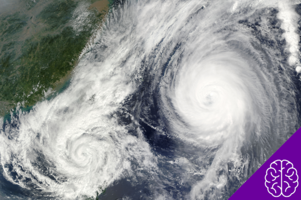
Weather does not always follow the patterns we expect. Some unusual weather events produce sights that seem almost impossible, such as lightning during a snowstorm, glowing flashes above thunderstorms, or enormous columns of swirling fire.
Although these phenomena may look mysterious, scientists have documented them and investigated the conditions behind their formation. From recurring lightning displays to rare atmospheric occurrences, these five examples reveal just how surprising the weather can become.
1. Thundersnow: When Lightning Strikes During a Snowstorm
Thunder and lightning usually bring to mind warm summer afternoons. However, these conditions can also develop during winter storms. Meteorologists call this phenomenon thundersnow, which occurs when lightning and thunder accompany snowfall instead of rain.
The combination is unusual because winter air generally lacks the warmth and instability that help ordinary thunderstorms develop. Certain weather systems, however, create favorable conditions higher in the atmosphere.
NOAA explains that thundersnow can develop when relatively warm, moist air rises above colder surface air. As the rising air cools, moisture condenses and releases energy, helping the storm grow. Collisions between ice particles and supercooled water droplets also contribute to the electrical charges needed for lightning.
What makes thundersnow unusual?
- Lightning and thunder occur while snow falls instead of rain.
- The storm can develop even when temperatures near the ground remain below freezing.
- Some events produce snowfall rates of two to four inches per hour.
Scientists have recorded several examples across the United States. During a major February 2013 snowstorm in Kansas, the National Weather Service documented thundersnow alongside intense snowfall. NOAA satellites also captured lightning associated with nor’easter storms along the East Coast in March 2018.
2. Catatumbo Lightning: A Storm That Returns Night After Night
In northwestern Venezuela, near the mouth of the Catatumbo River and Lake Maracaibo, thunderstorms create one of the world’s most remarkable lightning displays. Known as Catatumbo lightning, the phenomenon illuminates the night sky repeatedly throughout the year.
Unlike an isolated thunderstorm, this activity occurs with remarkable frequency. NOAA has reported that thunderstorms form over the Catatumbo region an average of 160 nights per year. Individual displays can last up to nine hours, producing repeated flashes across the sky.
The region’s geography helps explain this unusual pattern. Lake Maracaibo, the surrounding lowlands, and nearby mountains influence local wind circulation. Moist air from the lake and Caribbean Sea interacts with these conditions, encouraging warm air to rise and form storm clouds.
Some remarkable details about Catatumbo lightning:
- Frequency: Thunderstorms occur an average of 160 nights per year.
- Duration: Individual lightning displays can last up to nine hours.
- Location: The phenomenon takes place near Lake Maracaibo and the Catatumbo River in Venezuela.
Satellite observations give researchers another way to study the phenomenon. In 2012, NOAA’s Suomi NPP satellite captured nighttime thunderstorms near the mouth of the Catatumbo River using its Visible Infrared Imaging Radiometer Suite.
Catatumbo lightning shows how local geography can shape atmospheric behavior. It also demonstrates that some unusual weather events are closely connected to specific landscapes, where recurring conditions make certain types of storms more likely.
3. Mammatus Clouds: Strange Pouches Hanging From the Sky
Not every unusual atmospheric sight involves rain, wind, or lightning. Sometimes, the clouds themselves create the spectacle. Mammatus clouds appear as rounded pouches or bubble-like structures hanging from the underside of a larger cloud.
Their name comes from the Latin word mamma, meaning breast or udder, which describes their distinctive shape. They often form beneath the flat upper portion of large thunderstorm clouds, creating a sky that looks almost covered in hanging bubbles.
Most clouds develop as warm, moist air rises and cools. Mammatus formations involve more complex air movements. Pockets of cold, moisture-rich air descend from the cloud base into drier air below. Differences in temperature and moisture help create the rounded structures that give these clouds their unusual appearance.
The World Meteorological Organization recognizes mammatus as a supplementary cloud feature. NOAA also notes that these formations often appear beneath storm clouds, although their presence does not necessarily mean severe weather will occur directly overhead.
What to know about mammatus clouds:
- They often appear beneath large thunderstorm clouds.
- Their pouch-like shapes result from complex movements of air.
- They can look especially dramatic when sunset light illuminates their formations.
- They do not necessarily indicate that severe weather will occur directly overhead.
Despite their threatening look, mammatus clouds do not produce severe weather themselves. Instead, they offer a visible clue to the air movements taking place around the surrounding cloud system.
4. Ball Lightning: Glowing Spheres That Still Puzzle Scientists
Most people associate lightning with a brief, branching flash across the sky. Ball lightning is different. Witnesses describe it as a glowing sphere that remains visible for several seconds, sometimes moving through the air before suddenly disappearing.
Reports describe different colors, sizes, and movements. Some witnesses have seen orange, red, or yellow spheres, with estimated dimensions ranging from a golf ball to a basketball. Other accounts mention objects moving horizontally or appearing near buildings during thunderstorms.
Despite centuries of reports, scientists still lack a definitive explanation for how ball lightning forms. Its short duration makes it difficult to capture with scientific instruments, and researchers have limited reliable recordings to examine.
A 2021 study published in History of Geo- and Space Sciences reviewed 41 documented cases involving scientists and trained observers from eight countries. The reports covered observations made between 1868 and 2020, showing how the phenomenon has attracted scientific attention across generations.
What remains uncertain about ball lightning?
- Its exact formation process.
- Why some reported spheres appear to move through the air.
- Which proposed explanations best account for the observations.
Researchers have proposed several explanations involving electrical discharges, plasma, and chemical reactions. However, no single theory has gained universal acceptance. Ball lightning remains one of the most intriguing unusual weather events because credible observations exist, but the physical process behind them remains unresolved.
5. Fire Whirls: When Flames Form a Rotating Column
Wildfires can produce more than spreading flames, intense heat, and thick smoke. Under certain conditions, they can also create rotating columns of hot air, smoke, and burning debris known as fire whirls.
These formations begin when intense heat generates powerful rising air currents. If those currents interact with surrounding winds and existing air circulation, they can start rotating. The resulting vortex may lift flames, ash, and burning material high into the air.
Fire whirls vary considerably in size. According to the National Weather Service, some measure less than a foot in diameter, while larger formations can exceed 500 feet. The most intense examples may behave with the force of a small tornado.
A notable historical case occurred in April 1926 in California. Lightning struck tanks at an industrial facility, triggering a fire that burned for five days. During the incident, numerous fire whirls formed, including at least one with tornado-like characteristics. The Library of Congress identifies the event as an early example of scientific documentation of these formations.
Although people sometimes call the largest examples fire tornadoes, the terms do not always describe exactly the same phenomenon. Fire whirls result from the interaction between fire-generated heat and atmospheric circulation, while tornadoes develop through different storm-related processes.
Why are fire whirls dangerous?
- They can lift burning debris into the air.
- Winds may carry that material beyond the main fire area.
- Flying embers can create new ignition points and make wildfires harder to control.
These unusual weather events show how intense heat can influence local air circulation and create dangerous conditions beyond the immediate flames.
What These Phenomena Reveal About the Atmosphere
From lightning that accompanies heavy snowfall to glowing spheres that researchers still struggle to explain, unusual weather events show that the atmosphere can behave in unexpected ways. Some result from specific combinations of temperature, moisture, wind, and geography. Others remain difficult to understand because scientists have limited opportunities to observe them directly.
Documenting these occurrences helps researchers investigate atmospheric processes, recognize potential hazards, and improve weather monitoring. Even when an explanation remains incomplete, each reliable observation adds another piece to our understanding of how the atmosphere works.